|
The US military currently issues escape maps printed on
material made of high density polyethyle fibers.
This water resistant material is very strong and
difficult to tear, but can easily be cut with scissors.
The material is sold by the DuPont Company under the
trademark Tyvek. If you are not familiar
with Tyvek, next time you go to the Post Office look for
their Express Mail envelops. They are made from
Tyvek, although the material the military uses is
thicker and stiffer.
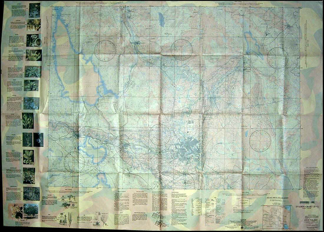
The Tyvek escape maps contain topographic maps at a
scale of 1:200,000. Printed in the margins is
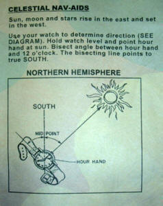
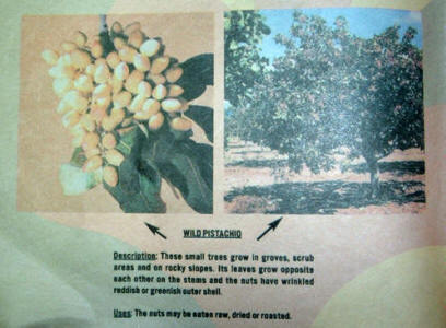
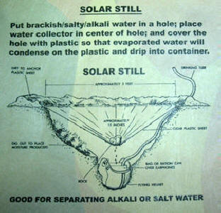
extensive survival information particular to the
geographic region. Useful information regarding
navigation, personal hygiene, signaling, first aid and
edible plants is included. Other uses of the maps
(as described on the maps) are:
1. Catch rain water.
2. Shade/wind/rain/shelter/cape/blanket.
3. Use as a bag to haul and purify large
quantities of water.
4. Use as a bag to haul food.
5. Line a hole or depression and use as a wash
basin for you, your food, or your clothing.
6. Wrap your clothing when swimming or fording
streams.
7. Wrap vegetation and use as a flotation
device (avoid sharp sticks inside and rocks
outside).
8. Wrap your torso as an extra layer of
clothing.
9. Wrap your sleeping gear during foul
weather.
10. Splint a broken wrist.
11.
Plug a sucking chest wound.
Below is an example of a current Tyvek escape map.
The maps are identified by evasion charts (EVC) numbers
and are issued primarily in survival bags for aircrews,
but are also used by special operations troops.
The Department of Defense's National
Geospatial-Intelligence Agency prepares and prints the
maps.
|