During World War II, the United States and Great Britain produced in excess of 3.5 million silk maps and cloth maps for Allied military personnel to use as escape maps. In 1940, the British military intelligence unit, known as MI 9, started issuing silk maps for use by British aircrews shot down over enemy occupied territory in Europe. The silk maps were intended to assist airman in evading capture. MI 9 also smuggled silk and tissue paper escape maps into POW camps in Germany along with other escape aids to encourage POWs to attempt escape.
After the US's entry into WWII, US military intelligence officers learned of the activities of MI 9 and established a similar intelligence unit referred to as MIS-X, which began mass producing cloth maps and tissue paper escape maps for US military personnel. The first US cloth maps were printed on balloon cloth, but soon thereafter a more suitable material, acetate rayon, was found and used for all subsequent cloth maps.
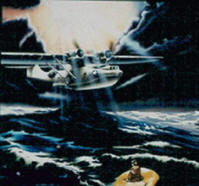
This website recounts the histories of British silk maps and US cloth maps prepared for the Army Air Forces and Navy, as well as the two US organizations that prepared the escape maps, the Army Map Service and the Aeronautical Chart Service. Also, included is the history of the oil cloth charts used by the US Navy on life rafts for survival purposes. The site contains many photos of these silk and cloth maps, along with some escape maps produced during WWII by the Survey of India and the RAAF. A few photos of tissue paper escape maps are also included.
All information contained on this website is for educational purposes only. It is dedicated to the Allied men and women who saved the world from tyranny.